MOSTA
SITES OF HISTORICAL INTEREST
ANCIENT SITES
Mosta's geographical location and topography have always attracted humans to found settlements here.
A rich array of ancient sites going back to the earliest documented peoples and cultures found on these islands is a testimonial to this very fact.
To better comprehend this network and progression, one must first look at the immediate surroundings of Mosta and its relative proximity to the earliest known major settlements founded on the Mdina/Rabat promontory, as well as to the sea.
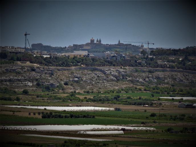
Mdina as seen from Tal-Qadi Hill, between Salina and Burmarrad
Unknown to many, Mosta once overlooked the sea and Punico-Roman Port situated at Burmarrad.
The low flat ground underlying the natural fault was mainly an estuary resulting from the Wied il-Ghasel major valley system, and other valleys such as those of Ghajn Rihana and Qannotta, with marshland connecting to the sea which then reached far deeper inland.
The accumulation of silt over the centuries eventually pushed the sea water outwards.
By the time of the Arab take-over in the 9th Century AD, the marshes had extended over most of the plain, and were dubbed Bur Marradi, sick land, infested with mosquitos and malaria.
This situation persisted through the Middle Ages with more silting from the valley systems until the period of the Knights (1530-1798 AD).
The Order's grandmaster Alof de Wignacourt launched a project to re-utilise this wasteland by building a dam to stop seawater infiltration and a series of draining canals.
A small array of salt pans, probably of Roman origin was enlarged and re-organised, with structures added for the processing and storage of salt. This led to the area being known as Salina.

The land at Burmarrad was eventually covered with a layer of arable topsoil giving the area the look we know today.
Due to perpetual settling, a large tract of this land remains below sea level. This is clearly discernible when the area is flooded with rain water after a heavy storm.
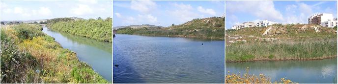
As for the marshland, some traces still survive, rendering a clearer picture of what the majority of the Burmarrad plain would have looked like.
For better ease of reference, we have split sites from antiquity into the following categories. Kindly click on photos or titles below to access the respective pages


Redoubt tal-Kavallieri (Falka Gap)
Pontijiet tas-Servizzi
Il-Fortizza tal-Mosta, il-Batterija tat-Targa, u
il-Victoria Lines
Xelters
Xelter Nukleari tan-Nato taht is-Civil defence Centre
Civil Defence Centre f’Misrah ghonoq
OTHER SITES
L-Imtiehen - Windmills
Mosta has 2 windmills, the oldest of which built in 1757.
Pontijiet - Bridges
Dar Salvu Dimech
Skola tas-Sorijiet Agostinjani
Skola Primarja fi Triq Grognet
Dar ta’ Gorg Grognet
Dar u Gnien Mifsud
Dar fi Triq San Gwann
Villa Gollcher u l-Gnien
The 17th Century farmhouse of Marquis Mallia Tabone now houses the Philanthropic Society ‘Talent Mosti’ which is run in collaboration with the adjacent school's council.
The farmhouse overlooking the valley of Wied il-Ghasel in Mosta was the property of the noble family of the Marquis Mallia Tabone and today houses various exhibitions which are held over the entire year. Exhibitions vary from paintings, photography, artisan work, hobbies, etc.
Literary & other cultural evenings are also frequently hosted here giving the opportunity to both budding and established writers, artists and musicians the opportunity to display and share their talents. Along with many other local organisations, this society too is run by volunteers.