
HPM OBJECTS
TO YET ANOTHER APPLICATION
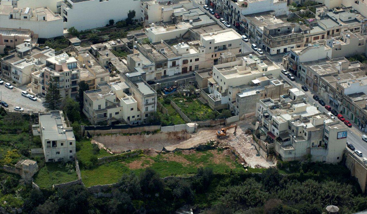
Above: The site in March 2012. The extent and magnitude of the proposed development may be clearly seen here. Notice the Girna at the very centre of the photo, boxed up for protection.
With reference to PA/00529/12 concerning a proposed development at 146/148, Constitution Street, Mosta, Harsien Patrimonju Mosti is hereby submitting its objections.
HPM would like to acknowledge that this new application shall exclude any further digging and shall consist of a smaller development footprint than that of former applications concerning the same site, but we are still contrary to this development due to the reasons listed below.
HPM would also like to point out that a former application was rejected twice by MEPA’s respective case officers, but a permit was issued by the DCC. This without any reports having been requested from MEPA’s Natural and Cultural Heritage Committees, and without the required attention having been made to the provisions set out in the Flora, Fauna and Natural Habitats Protection Regulations (L.N.311/06).
The following extract from the Case Officer’s 2007 refusal recommendation was never duly addressed by the DCC, and remains a serious point of objection from our end, particularly since no written justification was ever submitted despite this being a necessary and mandatory legal requirement stipulated within the Development Planning Act.
“1- The proposed development is unacceptable as it would result in a deleterious impact on the amenity of the area and of existing adjoining uses. It therefore constitutes bad neighbour and overdevelopment and so conflicts with Structure Plan policy BEN 1 which seeks to protect the amenity of existing uses and DC2005 policy2.7.” &
“2 –The proposed building which is situated on a valley (ridge),.”
May we also draw your attention to the highlighted text, whereby it is specified that the site constitutes a valley ridge, namely that of Wied
il-Ghasel. Verification of maps and plans leave no doubt that the site concerned is an integral part of this ridge, situated at the very centre of a locally and internationally protected area.
The central part of Wied il-Ghasel is registered within the World Database for Protected Areas lists as WDPA ID 174768 and given a Category III Natural Monument Status of international importance.
We now make reference to policy RCO.29 of 1990 which regulates land use in the case of proposed developments on valley sides and ridges, applicable to all such sites within or without development boundaries:
"No new physical development will normally be allowed on the sides of valleys and especially on valley watercourses except for constructions aimed at preventing soil erosion and the conservation and management of water resources"
While HPM acknowledges that the site may be within the development boundary, we must point out that around half of the proposed development shall be sited in an Environmental Constraints Zone. This area was designated by MEPA as such in the revised CMLP of July 2006, following the proposals made in 2002 and evidenced in Map A.11 of 2002. (See attached addendum)
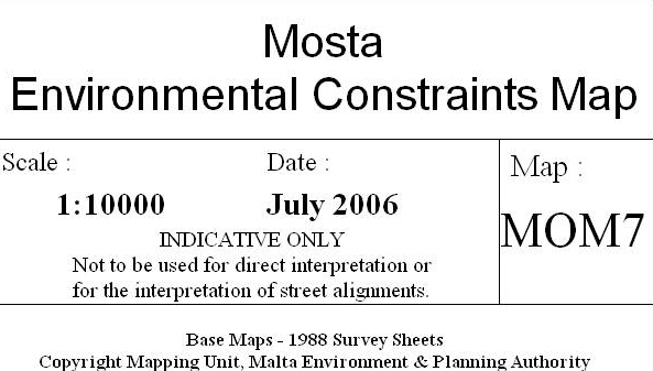
So whether the site is within the development pocket or ODZ, it is also important to consider the validity and limits to development as officialised within the “Mosta Environmental Constraints Map MOM7” of 2006. The Wied il-Ghasel and Wied Gananu of the Wied il-Ghasel Valley system is in its integrity considered an Area of Ecological Importance (Level2), rich in geomorphological and hydrological features.
Any approved plans should be issued according to these constraints, and also in line with several DPA policies governing such areas. (see addendum).
Furthermore, the permit should be refused since the proposed development shall take place at the very heart of the valley, right at the spot closest to the town centre, directly in line with the magnificent Rotunda Dome designated within the Central Malta Local Plan as a ‘Primary Town Centre’.
This is the last remaining example of a town having a preserved green core, complete with several iconic features of Maltese countryside and its rural qualities, along with a number of protected rural features.
This include a rare square-shaped Maltese corbelled stone hut (Girna) and several rubble walls, all resulting in a beautiful scene of great value and aesthetic quality. Such areas are also protected by local laws and regulations. Rural structures and walls of this sort are protected by Legal Notice 169 of 2004 and such an intrusive development would severely prejudice the value, aesthetic and other qualities held by such assets, once the immediate surroundings they form an integral part of have been built over.
This site is therefore rendered unique by the fact that no valley crosses through any other town on village on these islands, and particularly not through a town centre.
The said ridge also abuts a locally protected tree reserve, containing trees and shrubs of antiquarian and other value as within the provisions in Government Notice 269 of 1993 and relevant legislation.
Some of these trees actually overspill into the bordering fringe of the respective fields that constitute the site. The absolute proximity of this reserve should also be taken into consideration, along with the disruption of the natural habitat, and other ecological considerations by what remains a massive development. Thus even had the site not been important for other issues listed here, these fields remain an important buffer zone to the protected valley system. Such buffer zones and green core preservation are both adequately illustrated within the CMLP as well as within MEPA’s own statements and the very spirit of its mission statement.
HPM would also like to bring to your attention another application lodged with this same authority in 2007. We hereby refer to PA/06546/07 for a development just across on the opposite valley ridge.
This site also forms part of the very same area and is situated just diametrically opposite the proposed development. Both sites have lots in common, and all the basics are the same, even though the 3rd party site is much smaller and relatively less significant to the one that concerns this application.
The relevant case officer reports shows that in both instances the permit was refused. HPM would like to point out the many policies and regulations quoted by the respective case officers in justifying their refusals.
Whilst noting that the 3rd party site hereby referred to is considered ODZ, the grounds of refusal (made and referenced to by the respective case officers) concerns and fully applies to any site with the intrinsic qualities described, anywhere on the Maltese islands.
Considering the sensitivity and qualities of the site, and with reference to all the relevant legislation protecting this and similar areas, we strongly object to any further development and hereby ask the authority to refuse this application.
Addendum submitted with our Objection:
ADDENDUM
1. Link to Protected Planet clearly showing site location and also proving our claims and concerns
http://www.protectedplanet.net/sites/Wied_Il_Ghasel_Parti_Minnu_Nature_Reserve )
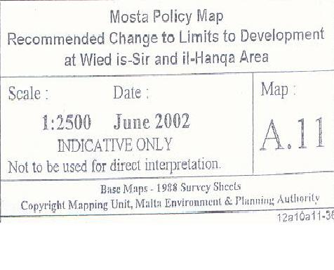
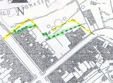
2. Above: Proposed change to Limits of Development Map A.11 of 2002

The following legislation is all fully applicable to the proposed development and site and made reference to in our objection.
Relevant Policies and Legislation set within the
Central Malta Local Plan
2.2.4
"Certain residential areas have become unpopular to live in due to the establishment over a period of time of a number of commercial and bad neighbourly uses. As a result, a number of urban areas have been transformed into areas of mixed use.
The importance of safeguarding the character of all residential areas cannot be overemphasised, and to this effect the objective seeks to improve the residential environment by controlling bad neighbour developments."
(relevant SP Policies BEN1, IND7)
(relevant CMLP General Policies CGO7, CG08)
2.3.2
"The provision of public open spaces within the urban areas of the Central Localities is very limited. Policies are therefore required in order to ensure the protection of these important landscaped spaces. The progressive introduction of more greenery in strategic urban locations and the embellishment of public open spaces and squares, including enhancement of the character of town and local centres will gradually upgrade the public realm. Within the various Urban Conservation Areas, internal open space enclaves play a very important role in maintaining a very high quality urban environment."
"The plan therefore identifies and protects these open space enclaves. The conservation, protection and enhancement of existing public open spaces private open space enclaves and urban ‘lungs’ is an objective of the Local Plan for improving the urban environment."
(relevant SP Policies BEN18, BEN19, UCO4, UCO6, UCO12, UCO13, RCO32)
(relevant CMLP General Policies CG09, CG11, CG18)"
15. CONSERVATION
Natural Resources in Rural Areas
15.21
The countryside and the coast are recognised as being two of the nation's most valuable natural resources. Together, countryside and coast provide the backdrop and raw material for much of the country's industrial, commercial, agricultural, and recreational activities. The intensity of use of these resources, and the delicate equilibria operating within and maintaining them, necessitate very careful management in order to harmonise the various uses of the countryside and coast and derive maximum benefit from them without their deterioration.
Recognising this, the Planning Authority will rigidly control development of the countryside and coast in general, and particularly of aquifer recharge areas and other important water catchment areas, afforestated areas,
sites of ecological and scientific importance, sites of scenic value,
coastal cliffs and sandy beaches, established and proposed bird sanctuaries, nature reserves, national parks, other types of protected areas, and of areas prone to erosion.
15.25
The limited land area and high population density result in strong pressure being exerted on the natural environment, particularly in areas which are relatively undeveloped. Many species, endemic and other valuable ones included, are threatened with extinction, while habitats are fast degrading. Some geological sites are in danger of complete obliteration, while many intrusive elements are spoiling the scenic value of the landscape.
15.26
The natural landscapes of the Islands are intimately related to agricultural activity. Both have to be protected from urbanisation, and conflicts between them have to be resolved.
End of Document